Heritage
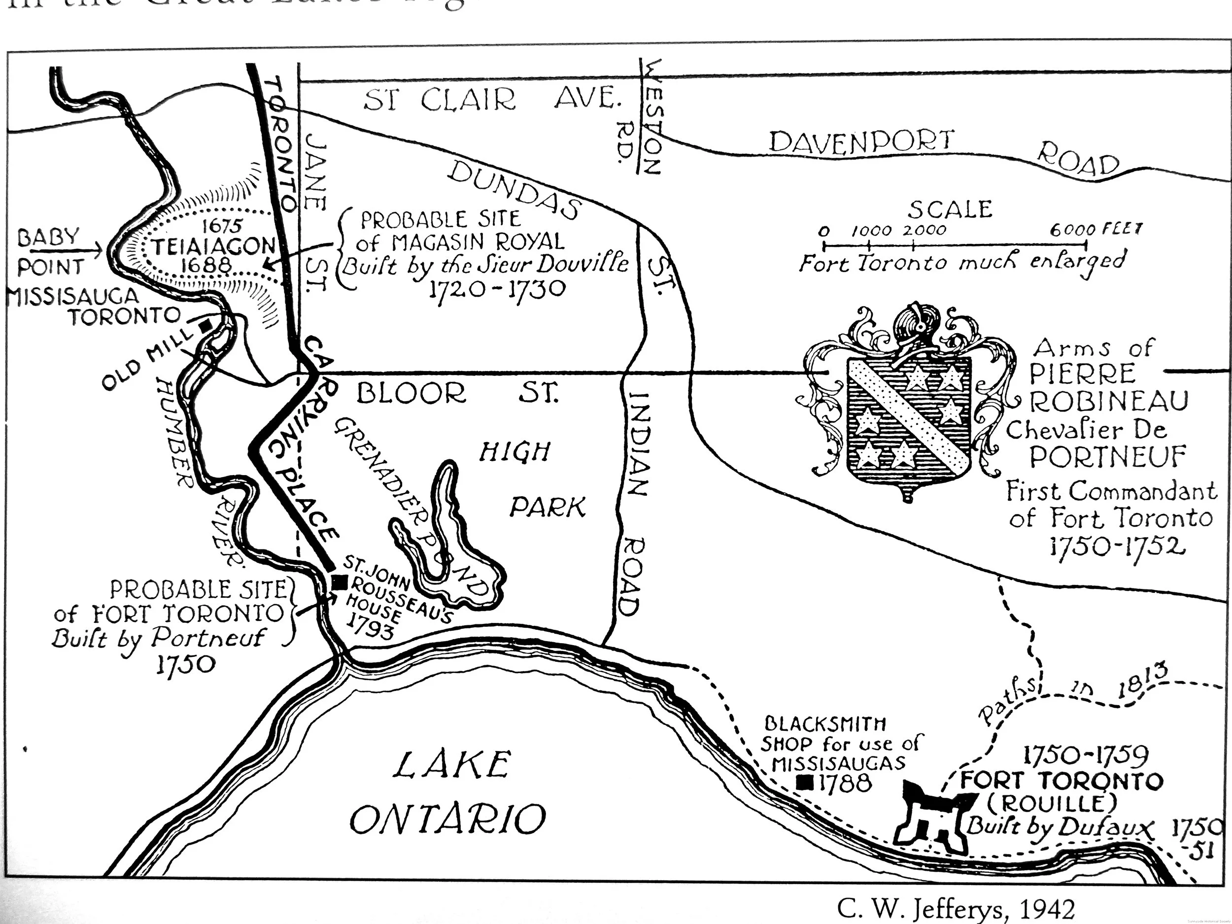
Baby Point was the site of indigenous use dating back thousands of years, including the Seneca village of Teiaiagon – one of the few known indigenous villages within present-day Toronto. The Toronto Carrying Place Trail, a significant trade and transportation route between Lake Ontario and Lake Simcoe, is a National Historic Event associated with this site.
Baby Point also has strong associations with Toronto’s French history – French explorers and missionaries are known to have visited Teiaiagon and used the Carrying Place Trail, an early French trading post may have been built on the site, and the point was later the estate of James Baby, a prominent landowner and government official.
The boundary includes three City-owned parks that Home Smith donated to provide ample green space for the residents of Baby Point along the banks of the Humber River.
Historical and Associative Attributes
These attributes are important features that convey the history of the district, from its indigenous use through to its development as a planned garden suburb. The plan of the neighbourhood, which exemplifies garden suburb design principles as envisioned by Robert Home Smith
The Baby Point Archaeologically Sensitive Area, associated with the district’s ancient indigenous and later European uses
The historic Seneca village of Teiaiagon and its potential archaeological remains
Contextual, Social and Community Attributes
These attributes support a sense of place, defining the context of Baby Point and its community values
The district’s historically strategic location atop a promontory adjacent to and overlooking the Humber River
The Baby Point Gates, which mark a formal entrance into the neighbourhood from Jane Street
1 Baby Point Road, the former residence of Robert Home Smith and one of the neighbourhood’s first houses
The Baby Point Club, a community and social hub founded by the neighbourhood’s early residents
Humbercrest United Church, an important neighbourhood institution and community landmark
Design and Physical Attributes
These attributes reflect the design of Baby Point as a garden suburb, guided by a set of principles that informed the streetscape and architecture of the neighbourhood
The curvilinear street pattern that follows and reflects the natural topography
The undulating pattern of houses that are sited and setback from the road, resulting in large landscaped yards and contributing to a park-like setting
The predominantly low-rise scale of houses, generally 2-2.5 storeys tall
The general use of brick, stone and stucco
The consistency of early 20th-century architectural styles, namely English Cottage (with Tudor influence) and Colonial Revival (with Georgian and Edwardian influence)
Natural Attributes
These attributes represent valued and unique natural resources that reflect the history of the district and contribute to a sense of place
Magwood, Etienne Brule and Cashman Parks, and the Humber River – a designated Canadian Heritage River – which provides a green edge to the neighbourhood
The landscaped front yards, with deep setbacks and extensive soft landscaping
The extensive mature tree canopy, much of which predates the neighbourhood’s residential development, was purposefully conserved

Natural Heritage
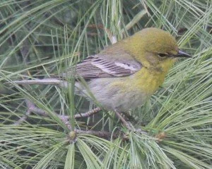
Birds of Baby Point
Residents and visitors alike have long enjoyed the vast and varied natural heritage of one of Toronto’s most beautiful neighbourhoods bordering the Humber River. From the summer of 2020 to the summer of 2021, a long-time resident of Baby Point documented and photographed 39 different species of birds in the backyard of his home on the north ravine of Baby Point Road.

Northern Cardinal

Golden Crowned Kinglet
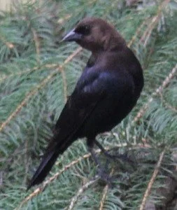
Brown-headed Cowbird
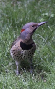
Northern Flicker
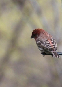
House Finch

Downy Woodpecker
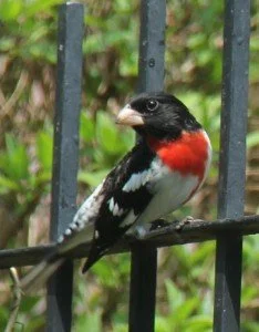
Rose-breasted Grosbeak

Red-winged Blackbird

Red-winged Blackbird
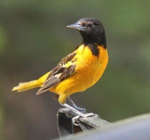
Baltimore Oriole

Broad-winged Hawk
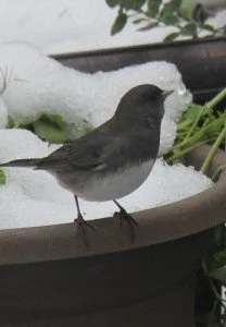
Dark-eyed Junco
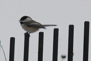
Black-capped Chickadee
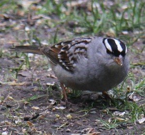
White-crowned Sparrow
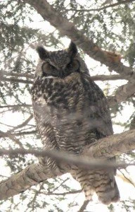
Great Horned Owl

American Robin
Ruby-crowned Kinglet
Magnolia Warbler

White-throated Sparrow
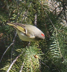
Great Crested Flycatcher
Magnolia Warbler

Red-bellied Woodpecker

Blue Jay
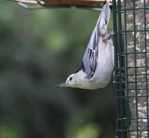
White-breasted Nuthatch
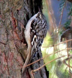
Brown Creeper
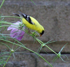
American Goldfinch

Red-tailed Hawk
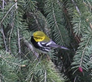
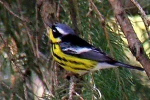
Pine Warbler

Eastern Towhee

Purple Finch

Purple Finch (female)

Cooper’s Hawk

(Myrtle) Yellow-rumped Warbler

Northern Parula Warbler

American Redstart Warbler (uncommon)

Northern Parula Warbler (top) with Myrtle Yellow-rumped Warbler (bottom)

Turkey Vulture

Cape May Warbler

Bay Crested Warbler

Bay Crested Warbler (female)
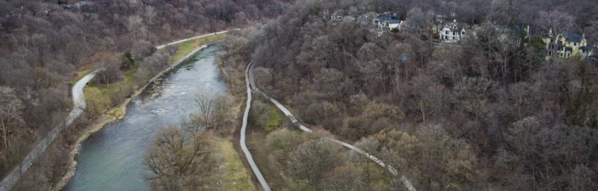
The Humber River
Baby Point is a promontory of land sitting above the east bank of the Humber. It is located between modern-day Jane Street and the Humber to its western boundary, with the Old Mill and Bloor Street to the south. The Humber River, which flows around the Baby Point promontory, was officially designated a Canadian Heritage River at a plaque unveiling ceremony in Toronto on 24 September 1999. The Humber is part of the Canadian Heritage River Systems. The Humber watershed has provided a home for many in the past 12,000 years, first for Aboriginal peoples and later for European explorers and settlers. More than half a million people of different cultures live in the Humber watershed, both rural and urban, and many more travel to the watershed for work and recreational purposes. The national designation was made because of its outstanding human heritage and recreational values, and the contribution it has made to the development of Canada.
Those who live on the Point are influenced daily by this beautiful river, which is important in defining another characteristic of the area.
Please take time to view and enjoy “What’s Up With the Humber River?”, a beautiful and informative exhibition on the Humber River curated by Kate Campbell, Master of Museum Studies and Master of Information Graduate, 2019. Many thanks to Kate Campbell and Heritage York for sharing this exhibition with our community.
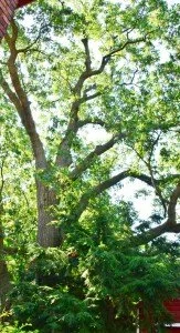
Tree of Provincial Significance
A 250 year-old Black Oak (photograph courtesy of David Slaughter), a Heritage Tree of Provincial Significance designated by the Ontario Urban Forestry Council, can be found behind 35 Baby Point Road. Many superb mature trees add visual beauty and welcomed shade in the heat of summer.


First Nations
While there is little record of the architecture of Teiaiagon Village, accounts from French explorer, Rene-Robert Caviler in 1680, suggest there were dozens of longhouses, such as the ones shown above, that housed hundreds of people. Longhouses housed several families along female lines. The construction consisted of driving wooden posts into the ground and weaving flexible branches between them, lashed by bark. The structures were then sheathed by elm or cedar bark. Sleeping platforms ran the length of the house, while 6 – 12 hearths would line the centre of the houses with vents above to allow smoke to escape. Entrances were often covered with animal hides. Teiaiagon was burned to the ground by French and Huron forces in 1687 in retaliation for previous aggressions by the Seneca and their English allies.
Built Heritage
Fur Traders and Coureurs de Bois
Teiaiagon was abandoned after being burned to the ground, and it was not until 1716 that the site was again home to a permanent structure. The Douville brothers constructed a trading post called Le Magasin Royal (also known as Fort Douville) believed to be near the site of the Baby Point Club where European items such as buttons, shirts, ribbons, combs, knives, looking glasses, axes, flour, lard, salt, pepper, prunes, raisins, olive oil, tobacco, vermillion, powder and shot were exchanged with trappers and aboriginal people for furs and pelts. Architecturally, Le Magasin Royal was described as ‘little more than a log cabin,’ but its significance lies in it being the first non-Aboriginal building in the Toronto area. The site was again abandoned in 1730 as new sites were built closer to Lake Ontario.
Pioneers and Settlers
Upon acquiring the land in 1820, James Baby fished and planted an apple orchard on his 114-acre property sandwiched between the small hamlets of Lambton Mills and Kings Mill. The cottage later built by his son James or his grandsons was unremarkable (pictured above in 1885, long after Baby’s death). The cottage’s precise location is not known but maps from the time show the estate near the southeast corner of the roundabout at Humbercrest Blvd. and Baby Point Rd.
20th Century Development
When Robert Home Smith acquired the Baby estate lands from the Government of Upper Canada, which in turn purchased it from the descendants of James Baby, he did so with the intention of developing the lands into a grand residential neighbourhood. In addition to the Baby Point subdivision, Home Smith also acquired lands for the Glebe subdivision (now known as the Kingsway), the Riverside subdivision (Riverside Dr.), the Old Mill subdivision and the Bridge End subdivision (east side of the Humber River above the York Old Mill Tennis Club), all along the Humber River Valley. Angliae para Anglia procul (A bit of England far from England) was the project’s slogan, reflecting Home Smith’s architectural vision for the community. This encompassed more than just the homes with plans for a ‘noble city park and boulevard’ with the development of street planning, architecture and construction, capturing the essence of England. Home Smith offered potential purchasers of land plots architectural and construction services, but also gave them the option of using their own architects, provided their design met with Home Smith’s approval and complied with a long list of covenants the owners agreed to for a period of 30 years. Home Smith’s vision included recreational amenities, and he constructed the Old Mill Tea Garden (known today as The Old Mill), St. George’s Golf Course, tennis courts, lawn bowling greens, boat houses adjacent to the Humber River, and ultimately Sunnyside Bathing Pavilion and Amusement Park (in his capacity as Chairman of the Toronto Harbour Commission).
Land reserved by Home Smith allowed the creation of the Baby Point Club in 1923 by residents of the growing neighbourhood. The Baby Point Club has helped to maintain a small community atmosphere for more than 90 years and has been the social and recreational nucleus of Baby Point with tennis courts, a lawn bowling green, a skating rink and a clubhouse which has been expanded and renovated since its original build.